File:Map-New Earth-Hydrographical.jpg
Jump to navigation
Jump to search

Size of this preview: 800 × 422 pixels. Other resolutions: 320 × 169 pixels | 1,460 × 770 pixels.
Original file (1,460 × 770 pixels, file size: 188 KB, MIME type: image/jpeg)
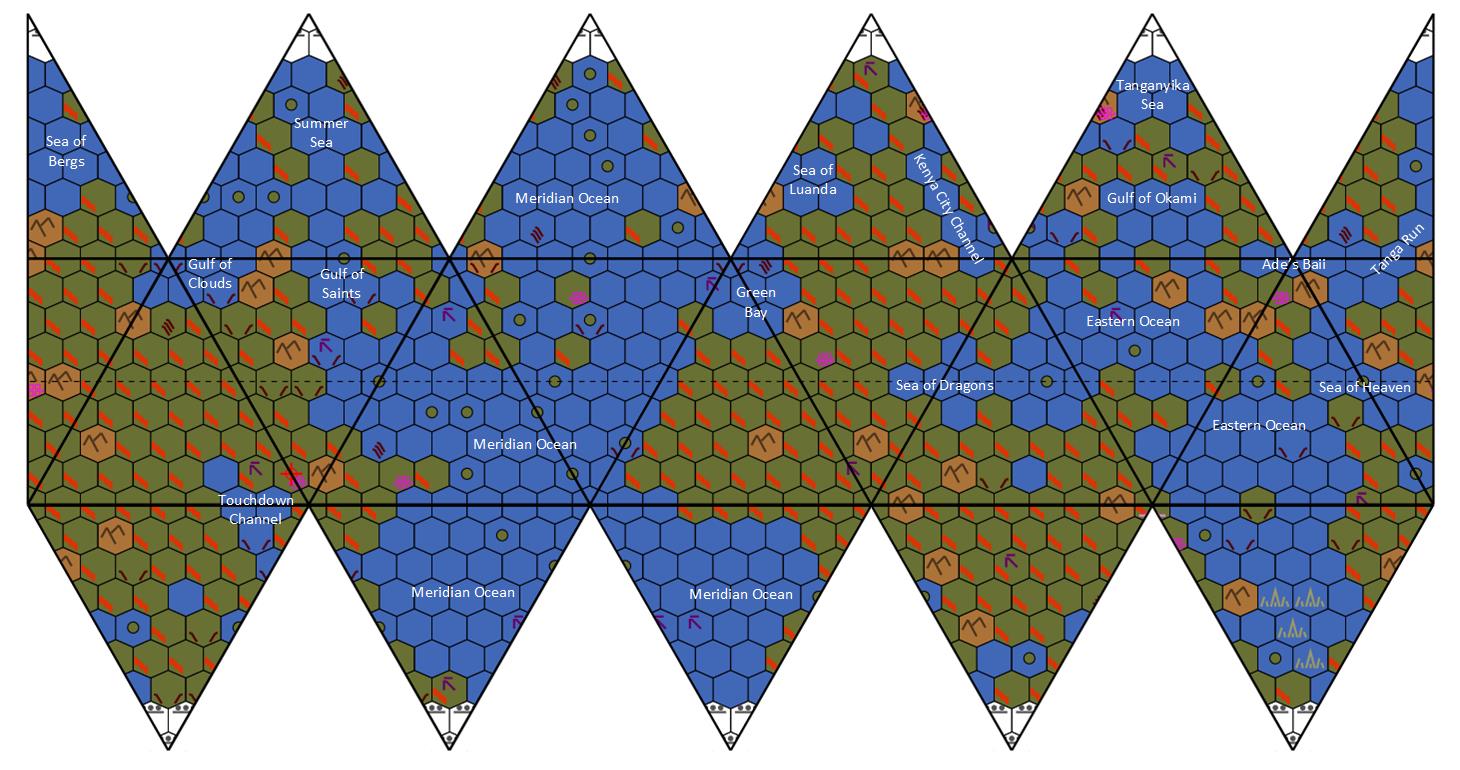
Summary[edit]
Map drawn by http://members.ozemail.com.au/ Annotated by BackworldTraveller
File history
Click on a date/time to view the file as it appeared at that time.
| Date/Time | Thumbnail | Dimensions | User | Comment | |
|---|---|---|---|---|---|
| current | 16:06, 15 June 2021 | | 1,460 × 770 (188 KB) | BackworldTraveller (talk | contribs) | Map drawn by http://members.ozemail.com.au/ Annotated by BackworldTraveller |
You cannot overwrite this file.
File usage
The following 11 pages use this file:
- Campaign:NHNE/Places/Ade's Baii
- Campaign:NHNE/Places/Cloudy Bay
- Campaign:NHNE/Places/Eastern Ocean
- Campaign:NHNE/Places/Gulf of Saints
- Campaign:NHNE/Places/Ice Strait
- Campaign:NHNE/Places/Meridian Ocean
- Campaign:NHNE/Places/Sea of Bergs
- Campaign:NHNE/Places/Sea of Heaven
- Campaign:NHNE/Places/Summer Sea
- Campaign:NHNE/Places/Tanga Run
- Campaign:NHNE/Places/Western Strait