File:IGSEncha 1110.png
Revision as of 22:38, 14 November 2012 by Imperial Grand Survey (talk | contribs) (Rindis style subsector map for Encha subsector in the Fulani sector ~~~~)
Size of this preview: 389 × 599 pixels. Other resolutions: 156 × 240 pixels | 413 × 636 pixels.
Original file (413 × 636 pixels, file size: 65 KB, MIME type: image/png)
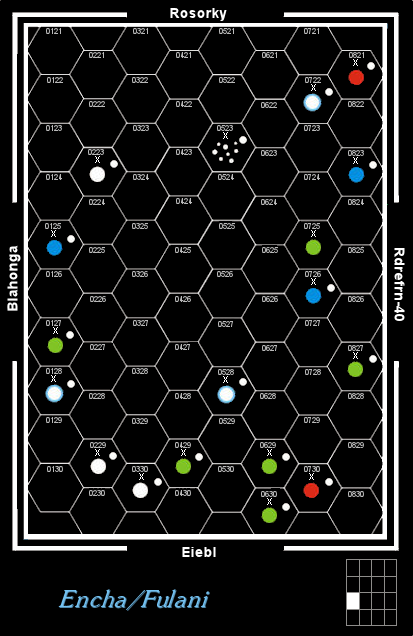
Rindis style subsector map for Encha subsector in the Fulani sector Imperial Grand Survey (talk) 22:38, November 14, 2012 (UTC)
File history
Click on a date/time to view the file as it appeared at that time.
| Date/Time | Thumbnail | Dimensions | User | Comment | |
|---|---|---|---|---|---|
| current | 04:05, 11 February 2013 | | 413 × 636 (65 KB) | Maintenance script (talk) | Importing image file |
You cannot overwrite this file.
File usage
The following page uses this file: